LAMPANG - CHIANG MAI
This was going to be the hardest day, which we left until last (anyway we had no choice); the steepest and the longest stage. Waking up early we left Lampang in the mist again. Once we got out of the city, we stopped before reaching what we thought was the start of the second hill for about ten minutes. As it turned out it was just a gradual incline, not as steep as the day before but certainly a lot longer. Riding up the Doi Khun Tan we were "encouraged" by the local truck drivers, asking us if we were okay or if we were completely mad.
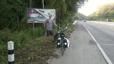
On the way to Chiang Mai
The Doi Khun Tan mountain range separates Lamphun from Lampang and ranges in elevations from 325 meters to 1,373 meters at its highest point. The area is a National Park and home to many interesting species of flora and fauna, as well as many historical points of interest. The mountain range is the boundary between Lampang and Lamphun provinces and at the same time the divide between the watershed of the Ping and the Wang Rivers.
We passed the elephant conservation center situated in the Thung Kwian forest park in Hang Chat district, about 32 Km from Lampang and about 8 kilometers from the summit. Demonstrations of elephant training and forestry skills are staged here two or three times a day, whole the center provides also health care for the elephants.
Finally after two and an half hours and 40 kilometers from our point of departure we reached the Khun Tan Pass at 642 meters of altitude. Steve kept holding the polka dot jersey as I reached the summit about four minutes behind him. Here we met up with our car and celebrated the ascent with some cool refreshments, while drivers were blowing their horn when passing the Chao Phor Khun Tan Shrine. We realized this was the end of our trip. Now we had to descent towards Lamphun and cycle through the valley of the Ping up to Chiang Mai. In fact nothing more than a formality…
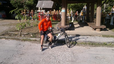
At the Khun Tan Pass
Lamphun was originally the center of the Mon Kingdom, known as Hariphunchai and believed to have been founded in the late 7th or early 8th century AD. The first and most famous ruler of Hariphunchai was Queen Chamma Thewi, whose legendary amorous and diplomatic exploits are the subject of numerous Lan Na folk tales. Independency was lost in the late 13th century, when Lamphun was taken by King Mengrai and incorporated into his Lan Na Kingdom (million rice fields). We would see nothing of the city as the highway was bypassing the city in the east.
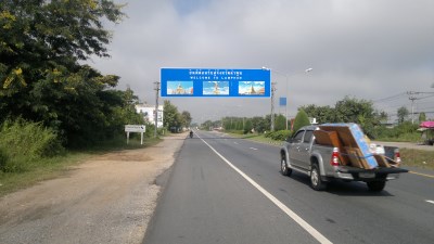
Lamphun welcoming us
As hawks we dived down the Khun Tan Pass direction Mae Tha and Lamphun. The downhill was very long, and we managed to reach 55 Km/Hr on the bike path. Steve filmed a short 2 minute stretch at top speed, which showed that there was a wide shoulder to the road for bikes which gave us some comfort of safety.
As we were getting closer to Chiang Mai we took a few rest stops. The hills had stopped and it was relatively flat in the Ping Valley for the last 40 km. We turned off the Highway at Thanarom and took road #106 via Saraphi to Chiang Mai. The latter road in was a nice, pleasant avenue with large Takhian trees on either side, reminiscent of the Champs-Élysées in Paris, although quite narrow in some places. We crossed the Ping River and entered the southeastern outskirts of Chiang Mai, the New City of King Mengrai. The last and longest track was finally less difficult than first thought.
At 1145 Hr we arrived at Baan Kaew Guesthouse, were a warm welcome was set up for our arrival. Pia had bought a nice bottle of Champagne and floral wreaths. We opened the bottle in great style, while the hotel staff adorned us with the flowers. We relaxed, Ad Fundum-ed the bottle and invited ourselves at a lunch at the Italian restaurant nearby. I indulged myself in a delicious Spaghetti Carbonara, followed by a nice piece of Tiramisu. To conclude the trip I offered Grappa as a digestive; for Steve the warm-up for a long drinking afternoon and an all night celebration. And yes, he earned it.
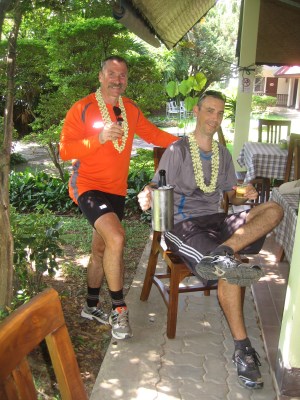
The reception at Baan Kaew Guesthouse
I was not much in the mood for drinking as I subscribed to the Ayutthaya World Heritage run, which took place two weeks later, so in the afternoon Pia and I went visiting Wiang Kum Kam, an ancient city located in Saraphi District on the left bank of the Ping River.
According to the chronicles and archaeological evidences, King Mangrai relocated the capital of the Lan Na Kingdom from Chiang Rai to the old city of Wiang Kum Kam on the banks of the Ping River in 1288. By 1296, King Mangrai had chosen a new site for the capital of the Lan Na Kingdom on the higher opposite bank. Wiang Kum Kam flourished during the reign of the Mangrai dynasty until the late 16th century. After Chiang Mai was conquered by the Burmese in 1558, Wiang Kum Kam became deserted. Years of flooding thereafter left the ancient city buried meters underground. In 1984, the Fine Arts Department discovered remnants of the old city around Vihan Kam Thom at Wat Chang Kham. Excavation afterwards led to the discovery of many ruins. Restoration followed as can be seen today.
We hired a horse-cart and visited most of the temple sites in the area. When sunset came near we returned to the guesthouse. Steve was sitting in the garden drinking a beer and talking to another guest, likely making plans for the night. I would not see him anymore until the next day. We went out for our dinner in a restaurant at the night market, concluding it with a large ice cream at Swensen. I went to bed, planning to make an early morning run along the Ping River.